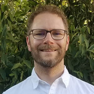
 Messier holds a joint appointment with the National Institute on Minority Health and Health Disparities. (Photo courtesy of Steve McCaw)
Kyle Messier, Ph.D., is the newest National Institutes of Health (NIH) Earl Stadtman Tenure-Track researcher (see sidebar) to join NIEHS. He is the first Stadtman researcher to join the NIEHS Division of the National Toxicology Program (DNTP), where he was welcomed by DNTP Scientific Director Brian Berridge, D.V.M., Ph.D.
Messier’s research — unique at NIEHS — uses a type of statistical model known as spatiotemporal. These models look for patterns in data and predict variables, such as exposures or disease, at new locations or during certain time frames.
“It’s great to have Kyle join our team,” Berridge said. “His skills provide us an opportunity to put real-world context around the hazard data we develop, generate human hypotheses to test with experimental data, and explore how to apply methods he develops in a systems toxicology approach. It also doesn’t hurt that he shares a passion for fly-fishing with a few of us.”
“My group is developing these methods and applications in environmental and human health exposure science, while also exploring innovative applications in toxicology,” Messier said. “We’re charting a new territory.”
Small-scale variations make big difference
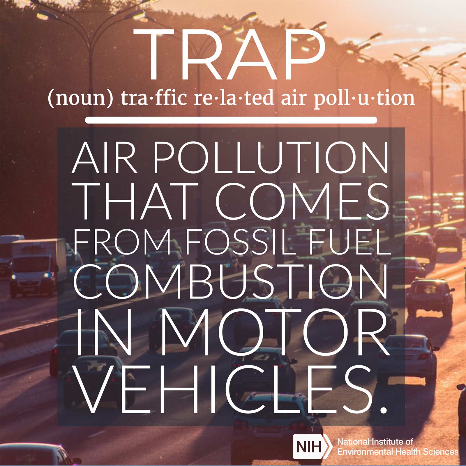
During his time as a postdoctoral fellow at the University of Texas-Austin, Messier used Google technology to produce high-resolution maps of air pollution. Google Street View, a feature of Google Maps and Google Earth, is generated from data gathered by cars with cameras attached to them. For Messier’s five-year study, the cars were modified to also collect traffic-related air pollution (TRAP) data in Oakland, California.
Before his study, little was known about how these street-level spatial differences in TRAP related to clinical health outcomes, such as heart attack, stroke, and other cardiovascular events. Messier and his colleagues wanted to estimate the relationship between highly-resolved spatial measurements of TRAP and heart-related emergency department visits and hospitalizations among the elderly.
“We found that small-scale variability, or changes from block to block, in air pollution was highly significant when looking at risk of cardiovascular events among the elderly,” Messier explained. “This suggests that within-neighborhood differences in TRAP are important to cardiovascular health outcomes.”
“This was a groundbreaking study that demonstrated the feasibility of research projects like this,” he said. “Now this study is being replicated in places like Houston, London, and in multiple cities in the Netherlands.”
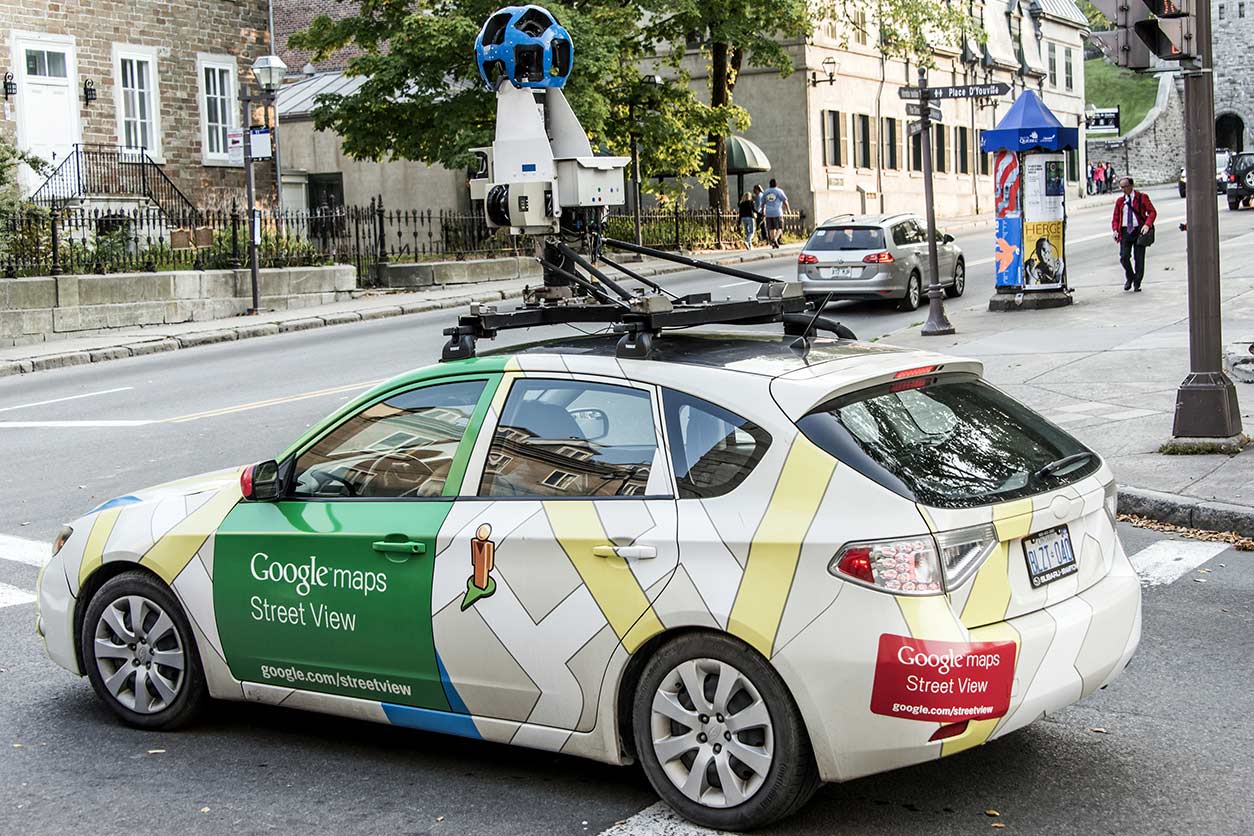 Messier used a Google street view car like the one shown to collect air pollution data for his study. (Photo courtesy of CL-Medien / Shutterstock.com)
Fixing populations, one study at a time
Messier said he really enjoys doing work that has an impact for large populations. “A doctor fixes a person, but a public health researcher can fix an entire population,” he explained.
Another feature he appreciates is that he is not bound to one particular pollutant or media, such as groundwater or air. “At the heart of it, we’re using spatiotemporal models to understand how environmental health impacts human health outcomes, regardless of whether we’re looking at air, soil, or water.”
Messier received a bachelor of science in environmental studies from the University of North Carolina at Asheville, and masters and doctoral degrees from the University of North Carolina at Chapel Hill.
Following his postdoctoral training, in collaboration with the Environmental Defense Fund, he served as a research assistant professor at Oregon State University through an NIEHS-funded Pathway to Independence grant.
Outside of work, Messier enjoys fly-fishing and spending time with the new baby he welcomed into the world in February. When asked what he would do if he had more free time, he responded, “Build a toy chest for my daughter!”
Citation: Alexeeff SE, Roy A, Shan J, Liu X, Messier K, Apte JS, Portier C, Sidney S, Van Den Eeden SK. 2018. High-resolution mapping of traffic related air pollution with Google street view cars and incidence of cardiovascular events within neighborhoods in Oakland, CA. Environmental Health 17:38.
(Sheena Scruggs, Ph.D., is a digital outreach coordinator in the NIEHS Office of Communications and Public Liaison.)